Learn to Read Ocean Data
Use satellite ocean data smarter. These articles explain what chlorophyll, water clarity (Kd490), and sea surface temperature maps actually show—and how to turn them into a plan for offshore fishing.
-
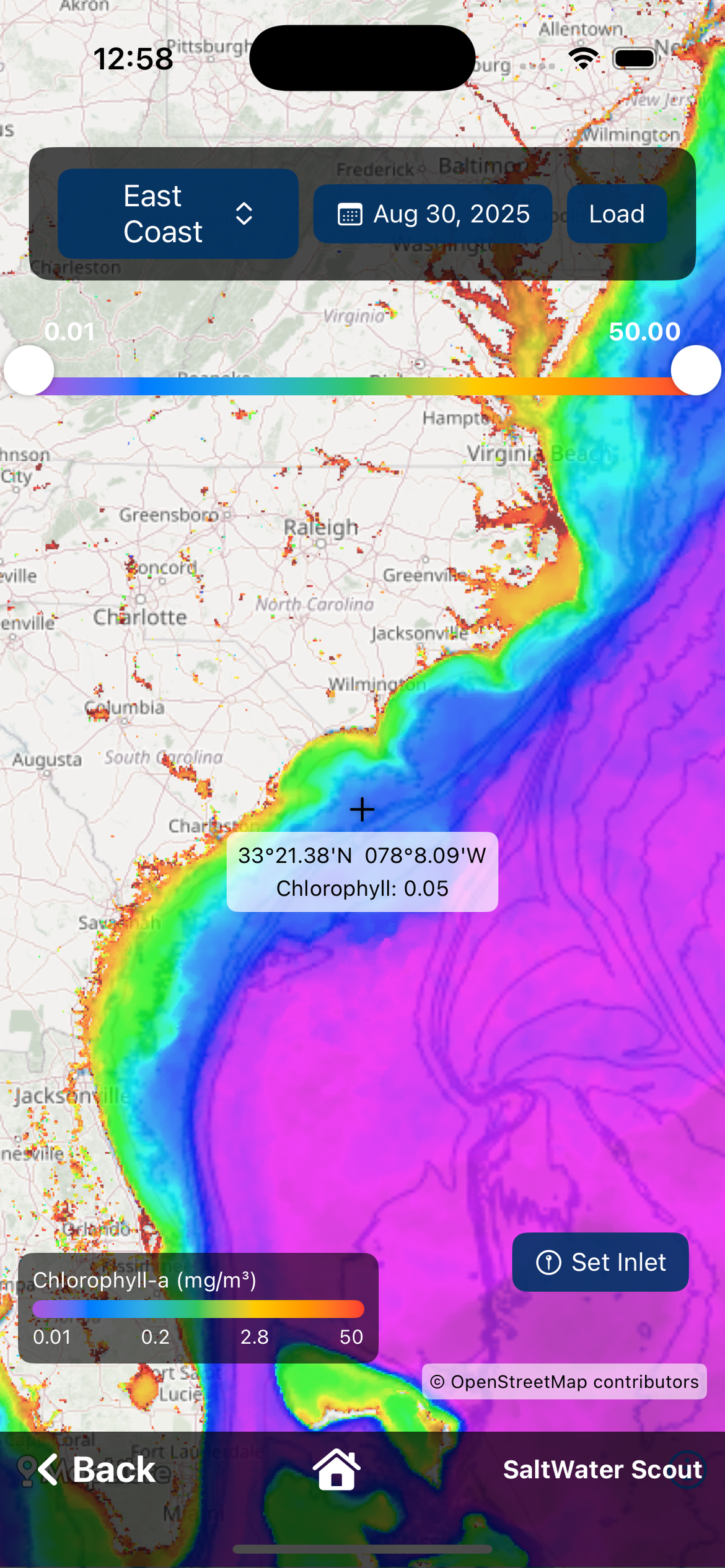 Understanding Water Clarity — What Chlorophyll & Kd490 Images Show
Learn what chlorophyll and Kd490 satellite maps really show and why edges and water clarity matter for offshore fishing.
-
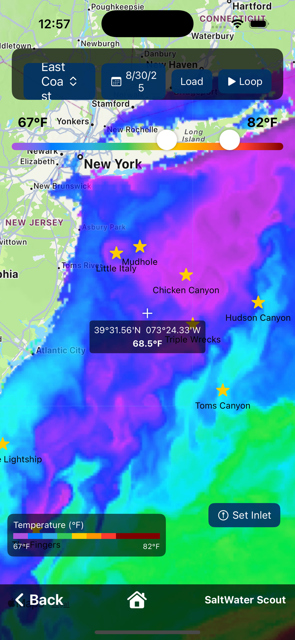 Reading Edges, Shapes, and Movement — Why Fish Care
Why fish stack on edges; straight vs broken edges, corners, pinch points; why movement matters more than a single image.
-
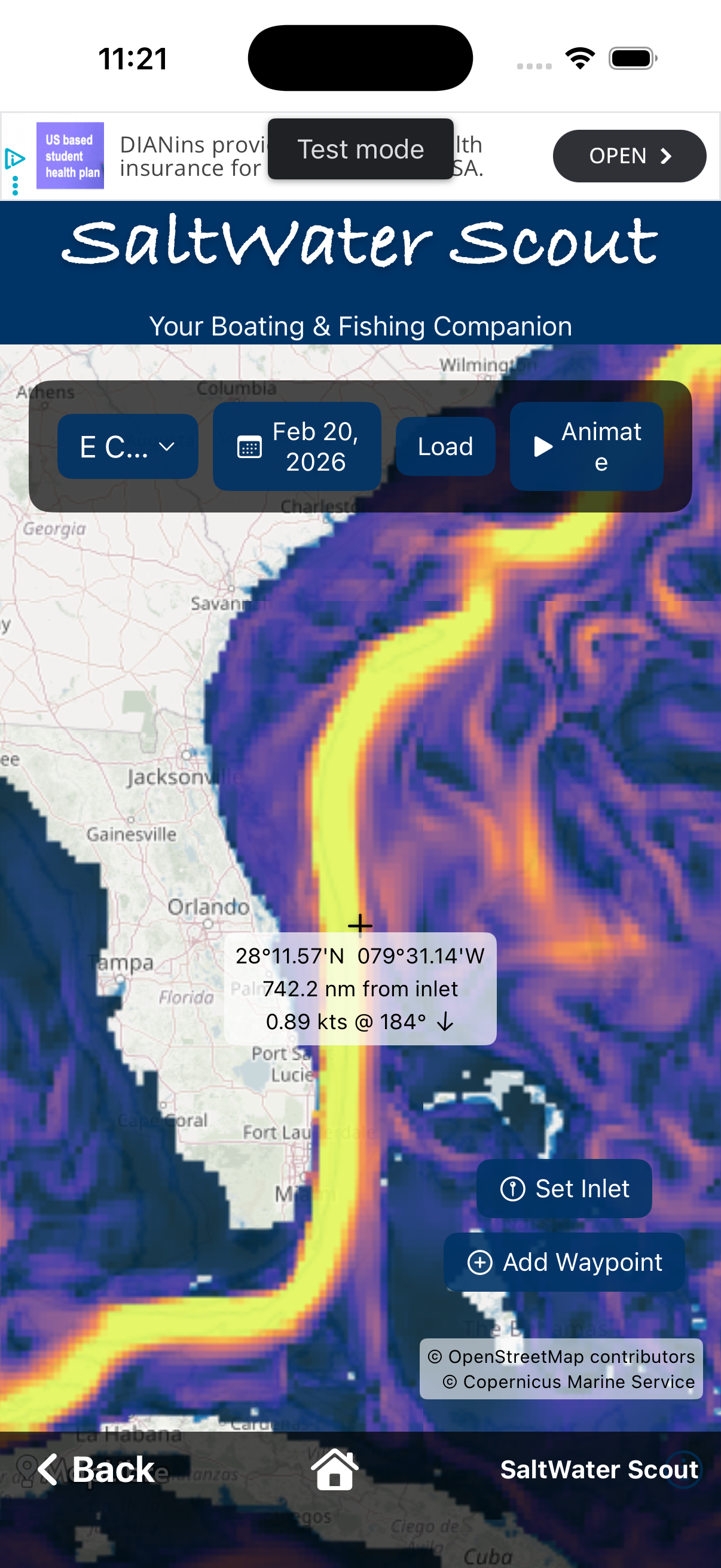 Reading Ocean Data — Putting It All Together
How SST, chlorophyll, clarity, and currents work as one system for a high-probability starting plan.